Weather Radar System
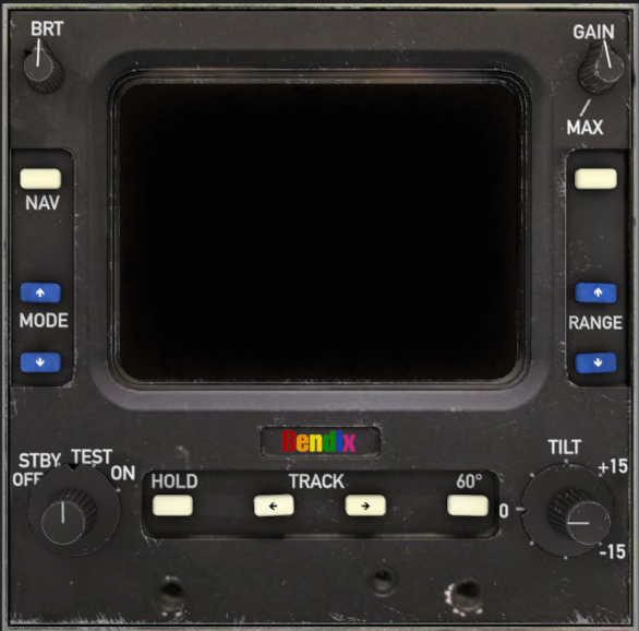
The Bendix WXR-2021A is an airborne color weather radar providing forward-looking precipitation and terrain awareness. The system consists of a Bendix/King IN-2021A control panel, a CRT-style weather radar display, and a scanning radar antenna. Radar processing is shared with the EFD84 EHSI map overlay, where applicable.
The system operates from two independent electrical circuits: the display bus and the antenna bus. Failure of either circuit results in a distinct system fault indication.
The Weather Radar Antenna is powered by AC power supplied by the Inverter bus.
Components
| Control | Function | Range |
|---|---|---|
| MODE / POWER KNOB | OFF / STBY / TEST / ON | 4 detents |
| SUB-MODE (WHILE ON) | MAP / WX / WXA, stepped via MODE ▲▼ | 3 states |
| TILT | Antenna tilt indication | −15° to +15°, 1° steps |
| GAIN | Receiver sensitivity | 0–100% |
| RANGE ▲▼ | Display range scale | 10 / 20 / 40 / 80 / 160 / 240 NM |
| TRACK ◄► | Azimuth offset cursor | ±30° |
| 60° | Narrows scan sector | 90° → 60° |
| HOLD | Freezes current picture | On / Off |
| STAB OFF | Antenna stabilization defeat annunciation | On / Off |
| NAV | Reserved | — |
Operating Modes
| Mode | Description |
|---|---|
| OFF | Removes electrical power from the radar display and antenna. |
| STBY | Warms the radar system and prepares it for operation. The antenna remains stationary and no radar returns are displayed. |
| TEST | Displays a fixed internal calibration pattern used to verify receiver operation and display integrity independently of weather conditions. |
| WX | Standard weather-detection mode. Precipitation returns are displayed using the color scale below. |
| WXA | Weather Alert mode. Operates identically to WX mode, but high-intensity (red) returns flash at approximately 1 Hz to emphasize hazardous weather cells. |
| MAP | Ground-mapping mode. Weather returns are suppressed and terrain reflections are displayed using the same green/yellow/red color convention, scaled according to terrain reflectivity. Display intensity is reduced to improve terrain definition. |
WX mode precipitation color scale:
- Green — Light precipitation
- Yellow — Moderate precipitation
- Red — Heavy precipitation
Display Presentation
The radar display presents a forward-looking sector centered on the aircraft symbol located at the bottom of the screen. Range rings are displayed at ¼, ½, ¾, and full selected range.
A sweeping scan line indicates antenna movement and refreshes the display whenever the radar picture is updated. Selecting the 60° scan option reduces the azimuth coverage from 90° to 60°, increasing target resolution within the selected sector.
Pressing MODE ▲▼ opens the radar menu, providing access to operating modes, display range, and the weather color legend. After a short period of inactivity, the display automatically returns to the live radar presentation.
Gain and Tilt
Gain controls receiver sensitivity and determines the reflectivity threshold required for radar returns to be displayed. Reducing gain suppresses weaker echoes, while increasing gain progressively amplifies returns and may saturate the display toward red regardless of actual precipitation intensity.
Tilt adjusts the antenna elevation between −15° and +15° and is provided for crew reference.
Within the current simulation, tilt indication is displayed but does not influence antenna scanning or the radar picture, as vertical beam modelling is not simulated.